
Haz una donación
Mapa topográfico Pryor Mountain
Haga clic en el mapa para ver la altitud.
Haz una donación
Acerca de este mapa
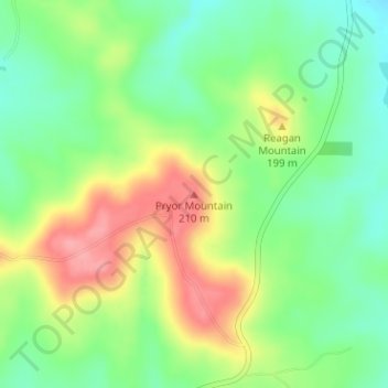
Nombre: Mapa topográfico Pryor Mountain, altitud, relieve.
Lugar: Pryor Mountain, Cherokee County, Texas, United States (31.72096 -95.18860 31.72106 -95.18850)
Altitud media: 158 m
Altitud mínima: 117 m
Altitud máxima: 213 m
Haz una donación
Otros mapas topográficos
Haga clic en un mapa para ver su topografía, su altitud y su relieve.
Alto
United States > Texas > Cherokee County
The town of Alto was laid out in 1849 and named for the Spanish word meaning "high" on account of the site's elevation on a drainage divide between the Neches and Angelina Rivers.
Altitud media: 130 m
Haz una donación
Alto
United States > Texas > Cherokee County
The town of Alto was laid out in 1849 and named for the Spanish word meaning "high," on account of the site's elevation on a drainage divide between the Neches and Angelina Rivers.
Altitud media: 130 m